Mount Redoubt, active volcano
I've been reading the news stories about Mount Redoubt the last few days, and it looks like it really is an active volcano, and may soon kick out some lava and ashes. One of the pictures I've attached below has the phrase "fire and ice", and all I can say is no kidding, an active volcano in the middle of winter -- how cool is that?
I don't know too much about Mt. Redoubt yet, but I'll share what I do know. I've been to Homer several times, and these pictures were taken from Highway 1 (the Sterling Highway), somewhere between Ninilchik and Anchor Point, Alaska, looking across the Cook Inlet at both Mt. Redoubt and Mt. Iliamma. Without any further ado, here are several pictures of Mt. Redoubt and Mt. Iliamma, along with pictures of two road signs that give nice descriptions and history of the mountains and wildlife in this area.
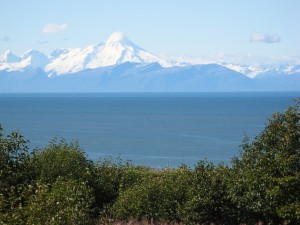
Here's a first picture of the Mt. Iliamma and Mt. Redoubt range. This picture is of Mt. Iliamma:
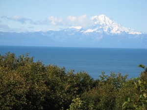
Here's a second picture of the Mt. Iliamma and Mt. Redoubt range, this time showing Mt. Redoubt:
I thought I had another picture that showed the proximity of the two mountain peaks to each other, but if I do, I can't find it at the moment. I'll keep searching ...
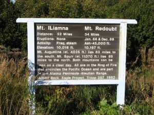
In the meantime, here's a road sign that provides some information on Mt. Iliamma and Mt. Redoubt:
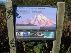
Here's a picture of a road sign that discusses Mt. Redoubt and its history as a volcano. The sign shows that Mt. Redoubt is 10,197 feet tall. That's big, especially compared to most peaks down in the Lower 48, but as a point of contrast, Denali is 20,320 feet above sea level (wow!).
As you can see on the signs, Mt. Redoubt is in the Lake Clark National Preserve. This is the area where Dick Proenneke built his cabin and lived or many years. Mr. Proenneke wrote a wonderful book titled "One Man's Wilderness", the name of which inspired this website.


